- REVIEWS
Camera Reviews 
More Reviews Mobile Reviews Photography Reviews - GALLERIES
- VIDEOS
- BUYER'S GUIDES
GPS-Enabled Cameras and Other Geotagging Options
Industry Perspective
GPS-Enabled Cameras and Other Geotagging Options
by Ron Leach
Whether you’re a backpacker, sailor, cyclist or simply a motorist, you are likely familiar with GPS devices which receive latitude, and longitude coordinates from global-positioning satellites to pinpoint your location. Applying this geographical information to digital images is called geotagging and it enables you to know not just when, but also where a photograph was taken.
Once GPS coordinates are stored with the other metadata associated with your images (shutter speed, aperture, focal length, etc.) it’s not only easy to recall where an image was taken, but you’ll discover new options for sorting, categorizing and storing your digital files. In fact, not only will you know where an image was shot, but you’ll be able to see the location simply by going to Google Maps.
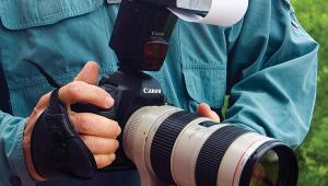
There are a variety of methods for geotagging your images, and GPS-enabled cameras are the most obvious. In fact, Nikon and Ricoh have already introduced cameras with built-in GPS chips and more are on the way. There are some technical challenges to be resolved before GPS-enabled cameras gain wide acceptance, however. One is the fact that all GPS devices take time to acquire the necessary satellite data when first switched on; and we’re talking minutes, not seconds. So for those bothered by “shutter lag” you might want to carefully consider your options.
Another hardware option is a small GPS receiver that attaches to your camera via the hot shoe. Jobo’s photoGPS does just that—recording location coordinates every time you take a photo. You then connect the device to your computer (while online); launch the Jobo software, and the location data is added to your images.
Stand-alone software is another method of geotagging your images, and the release of Apple’s iPhoto ’09 received a lot of attention because of this capability. Likewise, Microsoft’s Pro Photo Tools makes it relatively easy to add location data to your images. With the software approach, you enter location data manually after the image is already downloaded to your computer—essentially updating metadata fields with geographical information from your shoot. You can obtain the required information from a hand-held GPS device or even a map.
In any case, geotagging is a trend that’s here to stay.


![]()
Get the Latest Photo Tips, News & Reviews from Shutterbug!
| Camera Reviews Other Reviews | Mobile Reviews Photography Reviews Columns | News | Features | How-To | Resources |
 © 2026 Shutterbug
AVTech Media Americas Inc., USA
All rights reserved