- REVIEWS
Camera Reviews 
More Reviews Mobile Reviews Photography Reviews - GALLERIES
- VIDEOS
- BUYER'S GUIDES
Now Where Did I Photograph That Cactus Flower?; iPhoto ’09’s “Places” Gets You Maps And More Page 2
 |
|
|
Do I see myself always going for the GPS data option on every shot I make? In many cases it is not necessary, but considering all the data recorded with an image that I will never use, the GPS data capability is high in the rankings of what I might like to access from that lot later on. It surely saves time when trying to figure out in just what church that Mantegna altar painting hangs, or, for my project here, exactly where that cactus flower sat in bloom. In fact, when friends who record petroglyph locations for preservation heard I had the camera and software to test, they couldn’t wait to head out in the field to give it a try.
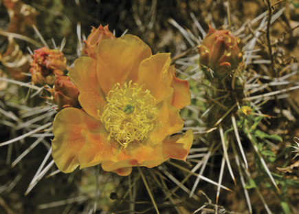
Where’s This Cactus Flower?
 |
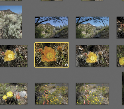 |
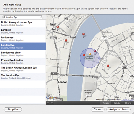
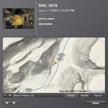
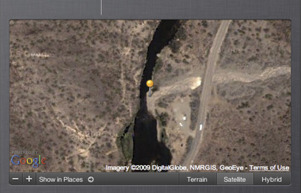
Having set up the GP-1 on the Nikon D300, all GPS data was recorded at time of exposure. I then downloaded the images to iPhoto ’09, where it became an “event.” Note the small “i” on the cactus flower shot on the index page (below)—this is where you click to “flip it” to show the image, the coordinates, and an option of visual guides to location. Here’s the topographic map, which also shows elevation—my favorite map view for this type of shot (below).
 |
You also have a satellite view of the same locale (below), which shows that I photographed this flower on the banks of the Rio Grande in the Orilla Verde area south of Taos. Zooming back on the map would reveal the wider area, and using a hybrid view superimposes road and street names on the satellite view so you could follow the map and find the cactus yourself.
 |
Resources
Nikon, Inc.—www.nikonusa.com
Apple Inc.—www.apple.com
iLife Tutorials—www.apple.com/ilife/tutorials
|
| |||||||||
- Log in or register to post comments


![]()
Get the Latest Photo Tips, News & Reviews from Shutterbug!
| Camera Reviews Other Reviews | Mobile Reviews Photography Reviews Columns | News | Features | How-To | Resources |
 © 2025 Shutterbug
AVTech Media Americas Inc., USA
All rights reserved