- REVIEWS
Camera Reviews 
More Reviews Mobile Reviews Photography Reviews - GALLERIES
- VIDEOS
- BUYER'S GUIDES
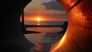
New Found Land; James Kay Documents The Return Of Glen Canyon
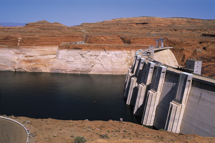
The story begins with a battle over water that dates back to the 1920s. Eventually the upper basin states of Utah, New Mexico, Colorado, and Wyoming, to hold back water from the lower basin states of Nevada, Arizona, and California, began in 1956 to build the Glen Canyon Dam on the Colorado River. The dam created the reservoir known as Lake Powell—and it flooded Glen Canyon, effectively drowning some 160,000 acres of a magnificent landscape that was termed the most beautiful canyonland of the Southwest.
 |
|
|
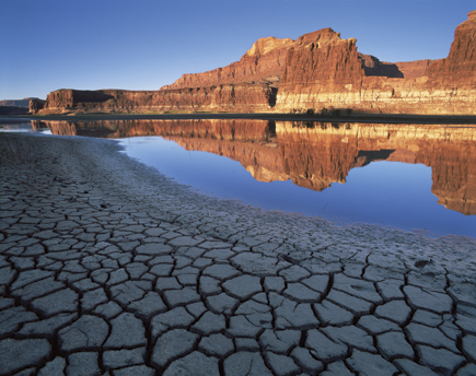
But in the past six years, because of drought and the diminishing snowpack in the Rockies, the water in Lake Powell has been dropping. In April, 2005, it reached a historic low of 145 feet below full pool, revealing much of the drowned land. Glen Canyon was coming back.
The incredible, intriguing story is detailed in Resurrection: Glen Canyon and a New Vision for the American West, by Annette McGivney, with photographs by James Kay.
 |
|
|
It was in 2003 that Jim realized something unique was happening. “I felt I had to get down there and photograph these newly revealed places that I knew about from books, but thought I’d never see,” he says. Jim worked over a period of five years, backpacking in, spending days hiking, exploring, and photographing, sometimes renting a pontoon boat or a small ski boat to follow the tributaries through the revealed canyon. “I’d spend two or three days in locations where the lake used to be. In some of these places maybe a mile of canyon had drained out, and I’d explore and check the light.” Often the key was seeing the light move one day and coming back the next to make pictures.
 |
 |
|
|
||
|
| |||||||||
- Log in or register to post comments


![]()
Get the Latest Photo Tips, News & Reviews from Shutterbug!
| Camera Reviews Other Reviews | Mobile Reviews Photography Reviews Columns | News | Features | How-To | Resources |
 © 2024 Shutterbug
AVTech Media Americas Inc., USA
All rights reserved